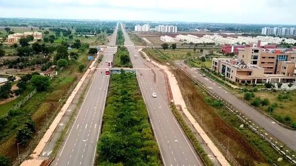
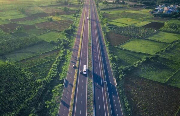
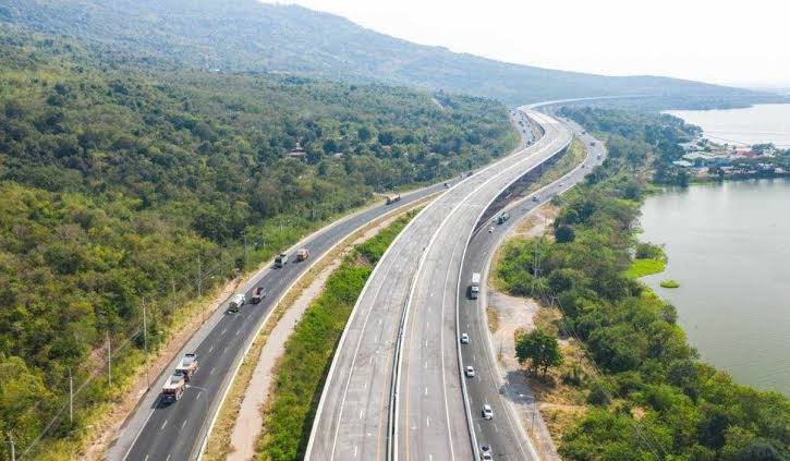
Punjab’s grain belt to Karnataka’s coastline — that’s the diagonal NH 52 traces across India, and it’s a route far fewer people know compared to NH 44 or NH 48. Running 2,317 km through six states, NH 52 is the fourth-longest national highway in the country, connecting Sangrur in Punjab to the coastal town of Ankola in Karnataka. It doesn’t pass through Delhi, Mumbai, or Bengaluru directly, which is exactly why it matters as a distinct freight and travel corridor rather than an overlap of the bigger-name highways.
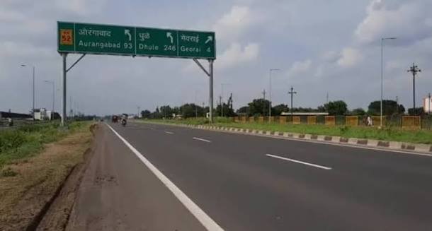
NH 52 Quick Facts
| Detail | Information |
| Starting point | Sangrur, Punjab |
| Ending point | Ankola, Karnataka |
| Total length | Approximately 2,317 km (some sources list up to 2,401 km) |
| States covered | 6 — Punjab, Haryana, Rajasthan, Madhya Pradesh, Maharashtra, Karnataka |
| Rank | Fourth-longest national highway in India |
| Formed from | Merger of 9 older highways, including parts of old NH 3, NH 11, NH 13, NH 63, NH 65, and NH 211 |
| Maintained by | National Highways Authority of India (NHAI) |
| Highway type | Mixed — several 4-lane stretches, with a notable 2-lane section still being widened |
| Speed limit | 100 km/h (cars on divided stretches), 80 km/h (buses/commercial vehicles) |
| Major cities linked | Hisar, Jaipur, Kota, Indore, Dhule, Solapur, Vijayapura, Hubballi |
Start and End: A Grain Belt to a Coastal Town
NH 52 begins at Sangrur, an agricultural town in Punjab known for its wheat and paddy trade, and finishes at Ankola, a small coastal settlement in Karnataka on the Arabian Sea — right where it meets NH 66, the highway running along India’s western coastline. It’s an unusual pairing: one end is landlocked and agrarian, the other is defined entirely by its relationship with the sea.
That contrast isn’t incidental. NH 52 exists largely to move agricultural output — wheat, cotton, oilseeds — from north Indian farmland toward ports and processing hubs further south and west, making it more of a working freight corridor than a tourist route.
Route Through the States
From Sangrur, the highway moves through Haryana via Narwana and Hisar before entering Rajasthan, where it runs a long stretch through Fatehpur, Jaipur, Tonk, and Kota. In fact, Rajasthan carries the single longest state-wise portion of NH 52 — a fact that surprises people who assume the highway is more evenly spread across its six states.
Crossing into Madhya Pradesh, the route passes Biaora, Shajapur, and near Dewas before reaching Indore, one of the largest commercial centres it touches directly. From Indore, NH 52 continues into Maharashtra through Dhule, Aurangabad’s outskirts, and Solapur — a major cotton and textile trading hub.
The final leg runs through Karnataka via Vijayapura (formerly Bijapur) and Hubballi before descending through the Western Ghats near Arebail Ghat toward Ankola on the coast. This last stretch, cutting through ghat terrain, is one of the most scenic — and slower — parts of the entire highway.
The Hubballi-Vijayapura Bottleneck
If there’s one section of NH 52 worth specifically flagging for current travellers, it’s the roughly 199-km Hubballi-Vijayapura stretch in Karnataka. This portion has remained a two-lane road even as traffic on it has grown significantly since the pandemic, leading to frequent delays from slow-moving mixed traffic — trucks, tractors, and buses sharing the same narrow carriageway.
NHAI began preparations in early 2026 to widen this stretch to four lanes, covering districts including Dharwad, Gadag, Bagalkot, and Vijayapura. Until that widening is complete, anyone planning to drive this specific section should budget extra time and avoid assuming highway-speed travel throughout.
Why This Corridor Matters Economically
NH 52 links Punjab and Haryana’s grain-producing belt to Rajasthan’s mineral and industrial zones, then continues into Madhya Pradesh’s Malwa region — itself a major soybean and agricultural hub — before reaching Maharashtra’s cotton belt around Solapur. The corridor effectively connects three distinct agricultural economies to Karnataka’s coast, where goods can move onward through port access near Ankola and neighbouring towns.
For real estate and logistics, the Indore and Solapur stretches in particular have seen notable warehousing and industrial growth, largely because they sit at the intersection of NH 52 with other major highways — meaning goods moving in almost any direction pass through these nodes.
What to Know Before Driving This Route
Road quality on NH 52 isn’t uniform. The Punjab, Haryana, and Rajasthan stretches are generally smooth, divided highways with decent signage. Through Madhya Pradesh and into Maharashtra, expect a mix of well-maintained four-lane sections interspersed with older two-lane portions, particularly around district boundaries.
The Karnataka stretch through the Western Ghats near Arebail Ghat involves hill driving with sharper curves — worth approaching with reduced speed rather than assuming open-highway conditions right up to Ankola. Toll plazas are placed at intervals across the developed sections; rates differ by state, with Punjab’s Pend plaza on the Sangrur-Dogal Kalan section charging around ₹95 one-way for cars as a reference point.
FAQs
Q1. Why do length figures for NH 52 vary between about 2,317 km and 2,401 km?
The difference comes from how realigned sections and bypasses are counted after highway mergers. The more widely cited, NHAI-linked figure is 2,317 km — treat that as the reliable number unless you’re cross-referencing a specific updated survey.
Q2. Is the entire NH 52 route four-lane and highway-standard?
No. While large sections in Punjab, Rajasthan, and parts of Maharashtra are well-developed, the Hubballi-Vijayapura stretch in Karnataka remains two-lane as of 2026, though widening work has begun. Don’t plan travel times assuming consistent four-lane speeds throughout.
Q3. Does NH 52 connect with other major highways like NH 48 or NH 44?
Yes — it intersects NH 48 at Jaipur and again near Hubballi, and crosses several other national highways including NH 65 and NH 27 at various points. This makes it a useful connector for multi-leg road trips rather than a standalone route most people drive end to end.
Q4. What’s the best time of year to drive the Karnataka ghat section near Ankola?
Winter and early summer offer the clearest, driest conditions through the Western Ghats stretch. Monsoon months bring heavy rainfall and reduced visibility in this hill section, so if timing is flexible, avoid scheduling that leg during peak monsoon.