Picture a road trip that starts under snow-covered peaks and ends where three seas meet the coastline. That’s NH 44 — India’s longest national highway, and arguably its most geographically dramatic. It begins in Srinagar, Jammu & Kashmir, and terminates over 4,100 kilometres later at Kanyakumari, the southern tip of Tamil Nadu. Along the way, it cuts through 11 states, links major economic hubs like Delhi, Nagpur, and Hyderabad, and carries a mix of pilgrims, truckers, and long-haul travellers who treat the highway as a rite of passage.
Formerly known as NH 7 before the 2010 renumbering exercise, NH 44 isn’t a single, uniformly built expressway — it’s a patchwork of older two-lane stretches, modern four-lane sections, and a few bottlenecks that NHAI is still working through. That mix is exactly what makes it worth understanding before you plan a route, book freight movement, or just satisfy curiosity about India’s road network.
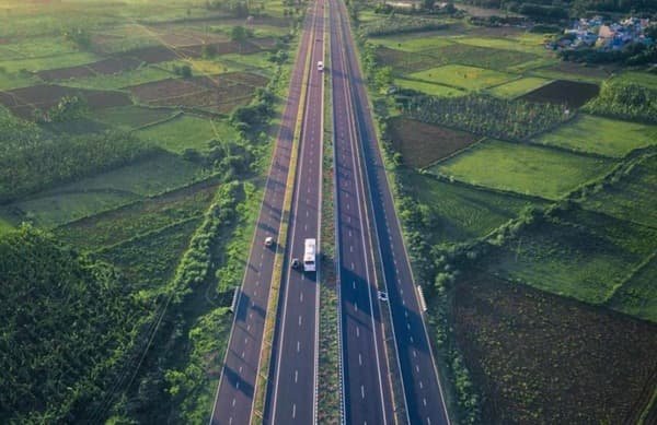
NH 44 Quick Facts Overview
| Detail | Information |
| Starting point | Srinagar, Jammu & Kashmir |
| Ending point | Kanyakumari, Tamil Nadu |
| Total length | Approximately 4,112–4,113 km (some sources cite ~3,745 km for a shorter realignment) |
| States covered | 11 — J&K, Himachal Pradesh, Punjab, Haryana, Uttar Pradesh, Madhya Pradesh, Maharashtra, Telangana, Andhra Pradesh, Karnataka, Tamil Nadu |
| Former name | NH 7 |
| Maintained by | National Highways Authority of India (NHAI) |
| Highway type | Mix of 4-lane and 6-lane sections; a few 2-lane stretches remain |
| Major cities linked | Jammu, Ludhiana, Delhi, Agra, Jhansi, Nagpur, Hyderabad, Bengaluru, Madurai |
| Speed limit (cars) | Typically 100 km/h on open 4-lane/6-lane stretches |
| Toll helpline | 1033 (24×7 NHAI assistance) |
Where NH 44 Starts and Where It Ends
The northern terminus sits in Srinagar, connecting into the Kashmir valley’s road network, while the southern end lands at Kanyakumari — the point where the Arabian Sea, Bay of Bengal, and Indian Ocean converge. That’s roughly the full vertical span of mainland India, and it’s part of what makes NH 44 such a commonly cited answer in general knowledge quizzes.
Along the way, it doesn’t run as a single continuous alignment in the way a modern expressway does. It was formed by merging several older highways — parts of the original NH 1, NH 1A, NH 2, NH 3, NH 26, and NH 75 — into one numbered route. That merger history explains why you’ll still hear locals in different regions refer to sections by their old numbers, especially truckers and older residents along the UP and MP stretches.
Route and the States It Passes Through
NH 44 threads through Jammu & Kashmir, a short stretch of Himachal Pradesh, Punjab, Haryana, Uttar Pradesh, Madhya Pradesh, Maharashtra, Telangana, Andhra Pradesh, Karnataka, and finally Tamil Nadu. Major cities and junctions along the corridor include Jammu, Pathankot, Ludhiana, Ambala, Delhi, Agra, Gwalior, Jhansi, Sagar, Nagpur, Hyderabad, Kurnool, Bengaluru, Salem, and Madurai before it reaches Kanyakumari.
Delhi is arguably the busiest node on the entire corridor — NH 44 intersects with several other national highways and the Delhi-Meerut and Delhi-Agra corridors here, making this stretch one of the most congestion-prone sections despite being fully developed.
South of Nagpur, the highway runs through the Deccan plateau into Telangana and Andhra Pradesh, passing Hyderabad’s outer ring road connections before continuing toward Karnataka. The Bengaluru-Krishnagiri stretch, part of the older Golden Quadrilateral network, is a well-built four-lane section and one of the smoother parts of the drive.
Why the Length Figures Differ
If you’ve searched for NH 44’s length before, you’ve probably noticed two competing numbers floating around: roughly 3,745 km and roughly 4,112–4,113 km. Neither figure is wrong exactly — they come from different measurement points. The larger figure, which NHAI’s own data and Wikipedia’s infrastructure listing tend to support, accounts for the full merged corridor including bypass loops and the historical extent of the highways NH 44 absorbed. The shorter figure reflects a more direct point-to-point measurement after certain realignments and bypasses shortened specific stretches. There’s no single official reconciliation between the two as of now, so if you see both numbers cited across sources, that’s the reason — not an error on either side.
Road Condition: What to Actually Expect
NH 44 isn’t uniformly world-class, and it’s worth setting expectations before a long drive. Large sections — particularly through Haryana, parts of UP, and the Bengaluru-Krishnagiri stretch — are well-maintained four-lane or six-lane carriageways. Other sections, especially through hilly parts of Jammu & Kashmir and pockets of Madhya Pradesh, still see landslide-related closures, single-carriageway bottlenecks, or maintenance issues that surface a few years after resurfacing work.
The Jammu-Srinagar leg is the most weather-dependent portion of the entire highway. Winter snowfall and monsoon landslides regularly disrupt traffic here, so anyone planning that stretch specifically should check road advisories rather than assume year-round accessibility.
Why NH 44 Matters Beyond Just Being “The Longest”
Length alone doesn’t make a highway significant — what NH 44 actually carries does. It’s the backbone that moves agricultural produce from northern grain belts toward southern markets, and it connects some of India’s largest industrial and IT clusters — Delhi-NCR, Nagpur, Hyderabad, and Bengaluru — into a single road corridor. For real estate and logistics planning, proximity to NH 44 has historically been a meaningful factor in property valuations and warehousing decisions along its route, particularly near Nagpur and Hyderabad where industrial corridors have grown around highway access.
It’s also a genuine pilgrimage and tourism route in sections — passing near Vaishno Devi access points in the north and connecting toward temple towns like Madurai in the south, alongside heritage stops like Agra’s monuments along the way.
FAQs
Q. Is NH 44 fully four-lane throughout its length?
No. Most of the highway has been upgraded to four or six lanes, but pockets — especially in hilly J&K terrain and a few older MP and Telangana stretches — remain narrower or under widening work. Don’t assume uniform highway-grade conditions for the entire route.
Q. What was NH 44 called before the renumbering?
It was NH 7 under the older numbering system used before 2010. Some older maps, GPS systems, and long-time drivers still reference it that way.
Q. Is it possible to drive the entire NH 44 in one trip?
Technically yes, but practically almost nobody does it in one continuous run. At 4,000-plus kilometres with mixed road conditions, most travellers cover it in planned segments — Kashmir to Delhi, Delhi to Hyderabad, Hyderabad to Kanyakumari — rather than attempting it as a single non-stop journey.
Q. Does NH 44 charge tolls throughout?
Toll plazas exist at intervals along the developed sections, particularly the four-lane and six-lane stretches maintained under NHAI’s build-operate-transfer and annuity models. Older, undeveloped sections may not have tolling. Toll amounts vary by stretch and vehicle category rather than being a flat fee for the whole route.
One thought on “NH 44 Highway (Srinagar to Kanyakumari): Route, Length, Start and End”