Not every long highway in India is a chaotic, traffic-choked corridor. NH 30 is something of an exception — a nearly 2,000 km route often cited as one of the safer long-distance highways in the country, largely because it passes through fewer major cities and carries comparatively lighter traffic than routes like NH 44 or NH 48. Running from Sitarganj in Uttarakhand down to Vijayawada in Andhra Pradesh, NH 30 links the Himalayan foothills to India’s east coast through six states.
If you’re trying to pin down exactly where NH 30 starts, ends, and what condition it’s in today, here’s the full breakdown.
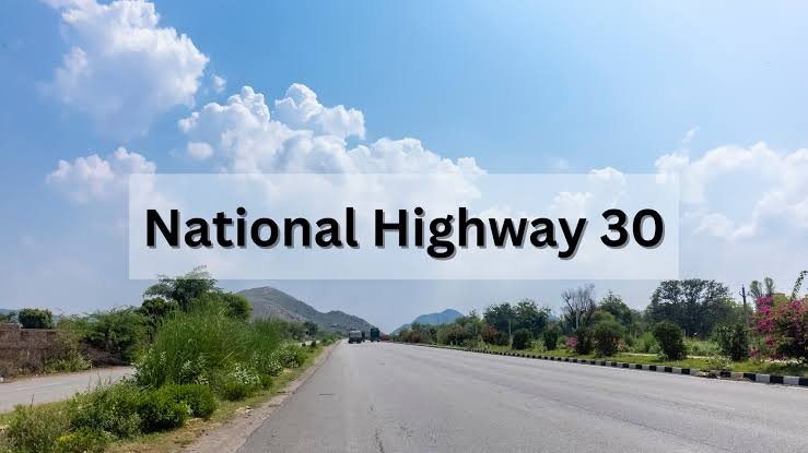
NH 30 Quick Facts
| Detail | Information |
| Starting point | Sitarganj, Uttarakhand |
| Ending point | Ibrahimpatnam, near Vijayawada, Andhra Pradesh |
| Total length | Approximately 1,984 km (some sources cite figures up to 2,116 km) |
| States covered | 6 — Uttarakhand, Uttar Pradesh, Madhya Pradesh, Chhattisgarh, Telangana, Andhra Pradesh |
| Direction | North-south corridor |
| Formed | 2010, during the national highway renumbering exercise |
| Maintained by | National Highways Authority of India (NHAI) |
| Highway type | Mixed lane configuration; largely two-lane and four-lane divided stretches |
| Speed limit | 100 km/h (cars), 90 km/h (light passenger vehicles), 80 km/h (heavy vehicles) on divided stretches |
| Major cities linked | Bareilly, Lucknow, Prayagraj, Jabalpur, Raipur, Bhadrachalam, Vijayawada |
Where NH 30 Begins and Ends
The highway starts at its junction with NH 9 near Sitarganj, a town in Uttarakhand’s Udham Singh Nagar district that sits close to the Terai region bordering Nepal. From there, it runs southeast for close to 2,000 km before terminating at its junction with NH 65 in Ibrahimpatnam, right on the edge of Vijayawada — one of Andhra Pradesh’s major trade and transport hubs on the Krishna river.
That geography alone tells you something about the highway’s purpose. It’s not built to connect India’s biggest metros the way NH 48 or NH 44 does — it exists to move people and goods through central India’s agricultural and mineral belts toward the eastern coast.
The Route Through Six States
Leaving Sitarganj, NH 30 enters Uttar Pradesh and passes through Pilibhit, Bareilly, Shahjahanpur, and Sitapur before reaching Lucknow. From the state capital, it continues through Raebareli, Pratapgarh, and Prayagraj — a stretch with heavy pilgrimage traffic given Prayagraj’s religious significance, particularly during Kumbh years.
Crossing into Madhya Pradesh, the highway runs through Rewa, Katni, Jabalpur, and Mandla, cutting through a region known more for its forests and waterfalls than industrial activity. This MP stretch is one of the quieter, more scenic parts of the drive.
In Chhattisgarh, NH 30 connects Raipur, Dhamtari, and continues toward Jagdalpur and Sukma — areas that see comparatively sparse traffic but sit close to mineral-rich districts important for the state’s mining economy.
The highway then enters Telangana through Bhadrachalam, a temple town on the Godavari river, and Kothagudem, before crossing into Andhra Pradesh and terminating near Vijayawada.
Why NH 30 Is Considered Comparatively Safer
Compared to India’s busiest highways, NH 30 sees notably lighter traffic through much of its central stretch — Madhya Pradesh and Chhattisgarh in particular. Fewer large cities directly on the route means less of the stop-start congestion and mixed-traffic chaos that characterizes highways passing through dense urban centres. That’s part of why it’s often flagged as one of the country’s relatively safer long routes for road trips, though “safer” here is relative — lower conflict points don’t mean zero risk, and drivers should still exercise the usual caution on unfamiliar stretches.
The trade-off is that this same lower density means fewer service amenities, rest stops, and fuel stations on the more remote Chhattisgarh and interior Telangana sections. Anyone planning to drive this route should factor that into fuel and break planning rather than assuming city-highway-level infrastructure throughout.
A Working Freight Corridor
NH 30’s real economic role is less about passenger travel and more about freight. It connects Chhattisgarh’s mineral belt — coal, iron ore, and related industries — toward Vijayawada, a port-linked city on the east coast. That makes the Raipur-to-Vijayawada leg particularly important for industrial and coal freight movement, even though it doesn’t carry the same passenger volume as the northern UP stretch.
Bhadrachalam, on the Telangana leg, adds a religious tourism dimension to an otherwise industrial corridor — its Rama temple draws steady pilgrim traffic that the highway supports year-round.
Road Conditions and What to Expect
Road quality on NH 30 varies more than on some of India’s premier highways. The Uttar Pradesh stretch, particularly around Bareilly and Lucknow, is generally well-maintained with decent four-lane sections. Through Madhya Pradesh and Chhattisgarh, expect a mix — some divided highway sections alongside older two-lane stretches, especially near Jagdalpur and Sukma, where development has lagged compared to more urbanized parts of the route.
The final approach into Andhra Pradesh through Bhadrachalam and Kothagudem has seen recent infrastructure investment, including bridge construction near Bhadrachalam completed in 2024, improving what was previously a bottleneck for pilgrim and freight traffic alike.
Toll charges along developed sections typically fall in the ₹60–120 range per plaza, varying by state and vehicle category rather than a flat highway-wide rate.
FAQs
Q1. Why do length figures for NH 30 range from about 1,984 km to over 2,100 km?
The variation comes from differing measurement points and how certain bypass or realigned sections are counted. The Wikipedia-listed and most consistently cited figure is approximately 1,984 km — a good reference point if you need one number.
Q2. Is NH 30 a good route for a long solo road trip?
It can be, given the comparatively lighter traffic through its central stretches, but the lower density of towns also means fewer fuel stops and service stations in Chhattisgarh and interior Telangana. Plan fuel stops in advance rather than assuming frequent amenities along the entire route.
Q3. Does NH 30 pass through any major pilgrimage sites?
Yes — Prayagraj in Uttar Pradesh and Bhadrachalam in Telangana are both significant religious destinations directly on the route, meaning traffic can spike considerably during festival seasons or the Kumbh Mela years around Prayagraj.
Q4. What’s the current road condition on the Chhattisgarh stretch near Jagdalpur and Sukma?
This section has historically lagged behind the rest of the highway in terms of lane width and surface quality, given the region’s lower urban density. It’s improving with ongoing NHAI work, but travellers should still expect slower average speeds here compared to the UP or Andhra Pradesh sections.