Widely known simply as “NH 209” even years after its official renumbering, this route connects Dindigul in Tamil Nadu to Bengaluru in Karnataka, running roughly 456 km through Coimbatore, Sathyamangalam, and Chamarajanagar. Under the current national highway system, this corridor is officially designated NH 948, a spur route off NH 48 — but given how deeply embedded the older name remains in local usage, maps, and even government district pages, this article covers the actual route under both names for clarity.
Route Quick Facts (Historically NH 209, Now NH 948)
| Detail | Information |
| Starting point | Dindigul, Tamil Nadu |
| Ending point | Bengaluru, Karnataka |
| Current designation | NH 948 (spur route of NH 48) |
| Total length | Approximately 456 km |
| State-wise split | Tamil Nadu: ~286 km, Karnataka: ~170 km |
| Maintained by | National Highways Authority of India (NHAI) |
| Major towns linked | Palani, Coimbatore, Sathyamangalam, Chamarajanagar |
| Key restriction | Night traffic ban through Sathyamangalam forest (Dhimbam ghat) |
| Speed limit | 100 km/h theoretical maximum; considerably lower through forest and ghat sections |
Where This Route Actually Goes
The corridor starts at Dindigul in Tamil Nadu and runs west through Palani before reaching Coimbatore, one of Tamil Nadu’s major industrial centres. From Coimbatore, the route continues through the Sathyamangalam forest region before crossing into Karnataka near Chamarajanagar, then continuing through Kollegal and onward toward Bengaluru.
This makes the route a genuine alternative connector between two of South India’s most important cities, distinct from the more commonly used routes via Salem or Krishnagiri.
The Sathyamangalam Forest: The Route’s Defining Feature
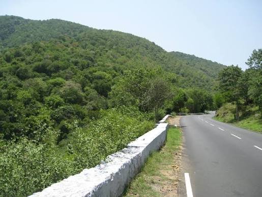
This is genuinely the most important thing to understand about this highway before travelling it. The route passes directly through Sathyamangalam Wildlife Sanctuary, a narrow, two-lane single carriageway stretch where wild animals — including elephants and other significant wildlife — can regularly be spotted on or near the road.
Because of this, movement of vehicles is prohibited between 8 PM and 6 AM specifically through the Dhimbam Ghat stretch, between Bannari and Karappallam. This is a firm, enforced restriction rather than a casual guideline, and travellers planning to use this route need to time their journey around it. For those needing to travel at night, the recommended alternate route runs via Erode, Mettur Dam, and Male Mahadeshwara Hills before rejoining toward Kollegal and Bengaluru — a considerably longer detour of around 389 km.
This forest region also carries a notable historical association: it was historically the territory of the notorious sandalwood smuggler and poacher Veerappan, whose activities in this exact area were a significant law-and-order concern for decades.
Chamarajanagar and the Alternative Route Function
Beyond its role connecting Dindigul to Bengaluru directly, this highway also functions as a secondary route between Bengaluru and Mysuru, with motorists able to divert at Malavalli toward Mysuru. It similarly serves travellers heading toward Kozhikode in Kerala via the Chamarajanagar stretch, making this corridor a genuinely versatile connector for multiple South Indian destinations beyond its primary endpoints.
That said, historically the Malavalli-to-Mysuru stretch via Bannur has been in poorer condition compared to other sections, which has discouraged some travellers from treating this as a reliable Bengaluru-Mysuru alternative despite the shorter distance it offers.
Widening Work and Infrastructure History
This corridor was, for a considerable period, notably the last major single-lane national highway route out of Bengaluru, prompting significant government investment to address the gap. The Union Government sanctioned roughly ₹2,400 crore for widening work covering approximately 170 km, including a substantial 67-km stretch specifically within Chamarajanagar district, aimed at converting the narrow town-and-village sections into a more capable, safer roadway.
This widening was specifically necessitated by how poorly suited the original road was to modern traffic volumes — passing directly through numerous towns and villages with limited capacity for the vehicle density it was carrying.
Road Conditions: What to Actually Expect
Given the mix of forest terrain, town-centre stretches, and ongoing widening work across different sections, road conditions vary considerably along this route. The Dindigul-to-Coimbatore stretch, being more urbanized, generally offers smoother driving. The Sathyamangalam forest section, beyond the nighttime restriction, involves narrow, winding two-lane road regardless of time of day. The Karnataka portion through Chamarajanagar and Kollegal has seen meaningful widening investment, though conditions can still vary by specific stretch depending on project completion status.
Speed Limits and Safety Notes
Standard national highway limits technically allow up to 100 km/h for cars, but this is essentially irrelevant through the Sathyamangalam forest stretch, where narrow road width and wildlife presence demand considerably reduced speeds regardless of posted maximums — and where, as covered above, night travel is prohibited entirely on the Dhimbam Ghat section.
Challan Rules and the Night Travel Restriction
Standard Motor Vehicles Act penalties apply across both Tamil Nadu and Karnataka, with overspeeding fines typically in the ₹1,000-₹4,000 range depending on vehicle category. However, the more consequential compliance issue on this specific route is the Dhimbam Ghat nighttime ban — violating this restriction isn’t treated as an ordinary traffic infraction, given its basis in wildlife protection and forest safety regulations, and enforcement here is generally strict.
FAQs
Q1. Why is this route sometimes called NH 209 and sometimes NH 948?
NH 209 was the highway’s designation before India’s 2010 renumbering. It’s now officially NH 948, a spur route of NH 48. The older name persists widely in local usage, older maps, and even some government websites, which is why both names remain in common circulation.
Q2. Can I drive through Sathyamangalam forest at night if I’m in a hurry?
No — vehicle movement is prohibited between 8 PM and 6 AM specifically on the Dhimbam Ghat stretch between Bannari and Karappallam. If your travel timing falls within this window, you’ll need to either wait or take the longer alternate route via Erode and Mettur Dam.
Q3. Is this route a good alternative to reach Mysuru from Bengaluru?
It can be, using the Malavalli diversion, but the Malavalli-to-Mysuru stretch via Bannur has historically been in poorer condition than more established routes. Check current road status before relying on this as your primary path if road quality is a priority.
Q4. What makes the Sathyamangalam stretch different from an ordinary forest road crossing?
Beyond the standard wildlife-crossing caution any forest road demands, this specific stretch carries a formally enforced nighttime travel ban and sits within a historically significant, once-notorious forest region. It’s treated with more regulatory seriousness than a typical rural highway passage through natural terrain.