At just 8 km, NH 966B holds a genuinely distinctive title: it’s among the shortest national highways in the entire Indian highway network. Connecting Kundannoor to Willingdon Island within Kochi, Kerala, this compact stretch punches well above its length in economic importance, serving as a critical link to Cochin Port and one of the city’s most significant maritime and commercial hubs.
NH 966B Quick Facts
| Detail | Information |
| Starting point | Kundannoor, Kochi, Kerala (junction with NH 66) |
| Ending point | Willingdon Island, Kochi, Kerala |
| Total length | Approximately 8 km |
| Former name | NH 47A |
| States covered | 1 — entirely within Kochi, Kerala |
| Notable status | Among India’s shortest national highways |
| Maintained by | National Highways Authority of India (NHAI) |
| Key infrastructure | Kundannoor-Thevara Bridge, Alexander Parambithara Bridge |
| Destination significance | Cochin Port, Central Institute of Fisheries Technology (CIFT) |
| Upgrade underway | Conversion to four-lane, 45-metre-wide corridor from Nettoor |
Where NH 966B Begins and Ends
NH 966B starts at Kundannoor, at its junction with NH 66, and runs a short but functionally significant distance to Willingdon Island — a man-made island developed as a major port facility under the Cochin Port Authority. Despite covering just 8 km, this highway carries outsized importance given what sits at its terminus: one of India’s most significant west coast ports, along with key institutions like the Central Institute of Fisheries Technology.
The Route Across Kochi’s Backwaters
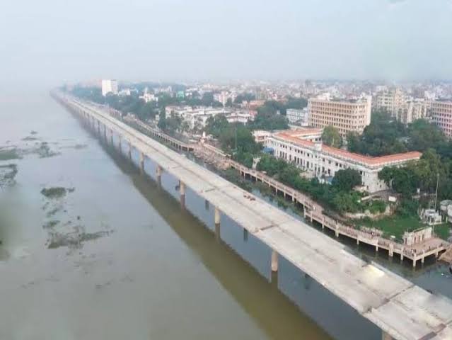
Leaving Kundannoor, NH 966B crosses the Kundannoor-Thevara Bridge, spanning the backwaters of Vembanad Lake — a critical link over Kochi’s extensive coastal waterway system. Continuing along its short path, the highway crosses the Alexander Parambithara Bridge, another significant backwater crossing that carries the route smoothly toward the port precincts.
Given Kochi’s flat coastal terrain, this stretch involves minimal elevation change, instead focusing on efficiently linking urban roadways with bridge infrastructure across a landscape genuinely divided by water at nearly every turn. The highway integrates through commercial and residential zones before reaching its terminus at Willingdon Island.
Why This Short Highway Matters So Much
It’s worth understanding precisely why an 8-km highway earns national highway status and significant infrastructure investment. Willingdon Island hosts Cochin Port, one of India’s major west coast ports, alongside the Central Institute of Fisheries Technology and other significant maritime infrastructure. NH 966B’s primary function is supporting efficient movement of goods — including substantial container traffic from the port — and passengers, while also working to alleviate congestion in the adjacent urban areas of Kundannoor and Thevara that would otherwise absorb this traffic through local roads.
For a highway this short, the volume and economic significance of what it carries is genuinely disproportionate to its length, making it a critical piece of infrastructure for Kochi’s broader port and trade economy.
The Four-Lane Upgrade Project
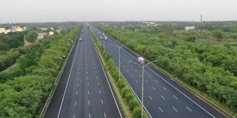
This is significant current infrastructure news worth understanding. NHAI has initiated a major upgrade project to transform NH 966B into a four-lane, 45-metre-wide corridor, extending from Nettoor on the Vyttila-Aroor stretch. This represents a substantial capacity increase for what has historically been a narrower connector road, directly responding to the growing volume of both port-related freight traffic and general urban commuter movement in this part of Kochi.
Given the highway’s role connecting to a major port facility, this widening reflects broader efforts to keep pace with increasing container and cargo volumes moving through Cochin Port, ensuring road capacity doesn’t become a bottleneck for the maritime trade this corridor supports.
Willingdon Island: More Than Just an Endpoint
Willingdon Island itself deserves specific mention as a destination — it’s a genuinely significant, purpose-built location rather than simply where the highway happens to end. Developed under the Cochin Port Authority, the island hosts major port operations alongside the Central Institute of Fisheries Technology, making it a hub for both commercial shipping and fisheries research and development. NH 966B’s role in connecting this island efficiently to the mainland road network via Kundannoor is fundamental to how both these sectors function within Kochi’s broader economy.
Road Conditions Along the Route
Given the highway’s short length and its role as a critical connector to port infrastructure, road conditions have historically needed to support genuinely heavy traffic despite the route’s brevity. With the four-lane upgrade project underway, expect improving conditions overall, though as with any active infrastructure project, some portions may currently reflect construction-related conditions until the widening work fully completes.
Speed Limits and Practical Driving Notes
Given the highway’s short length, urban setting, and mix of commercial port traffic alongside regular vehicle movement, don’t expect sustained high-speed driving conditions here regardless of any technical speed limit. This is fundamentally a functional urban and port-access corridor rather than a long-distance highway, and traffic density around bridge crossings and port access points naturally moderates achievable speeds throughout.
Challan Rules on NH 966B
Standard Motor Vehicles Act penalties apply, since this highway sits entirely within Kochi, Kerala, with overspeeding fines following the state’s standard rates. Given the corridor’s role supporting heavy container and freight traffic, enforcement here often extends to broader compliance considerations around commercial vehicle movement and loading regulations near the port access points, beyond routine speed monitoring alone.
FAQs
Q1. Why is such a short highway classified as a national highway at all?
Length alone doesn’t determine national highway status — strategic and economic significance does. NH 966B connects to Cochin Port and the Central Institute of Fisheries Technology, both of national economic importance, which justifies its national highway classification despite covering just 8 km.
Q2. Is the four-lane widening project currently complete, or should I expect construction?
This remains an active infrastructure project as of the most recent updates. Depending on your specific travel timing, you may encounter construction-related conditions on portions of the route until the full four-lane, 45-metre corridor is completed.
Q3. Does NH 966B connect directly to other major Kochi highways?
Yes — it starts at its junction with NH 66 at Kundannoor, making it straightforward to access from Kochi’s broader highway network if your destination involves Willingdon Island or the port area specifically.
Q4. What kind of traffic should I expect on this route given its port connection?
Expect a genuine mix of container and cargo truck traffic related to Cochin Port operations alongside regular commuter and local vehicle movement. This isn’t a route where you should anticipate light, purely passenger-oriented traffic, particularly during standard business and port operating hours.