This is a genuinely unusual case among India’s highways: the historic Mangaluru-to-Viluppuram corridor, once a single continuous route numbered NH 234, has since been broken into four separate highway designations following the 2010 renumbering exercise. Rather than one highway, today’s traveller covering this roughly 780-km journey would actually be driving NH 73, then NH 69, then NH 75, then NH 38 in sequence. Given how widely this route is still searched and referenced under its original name, here’s the complete, accurate picture of what the corridor actually looks like today.
Route Quick Facts (Historically NH 234, Now Four Separate Highways)
| Detail | Information |
| Starting point | Mangaluru, Karnataka |
| Ending point | Viluppuram, Tamil Nadu |
| Original combined length | Approximately 780 km |
| Current designations | NH 73 (Mangaluru-Banavara), NH 69 (Banavara-Mulbagal), NH 75 (Mulbagal-Vellore), NH 38 (Vellore-Viluppuram) |
| States covered | Karnataka, Andhra Pradesh, Tamil Nadu |
| Original state split | Karnataka: 509 km, Andhra Pradesh: 23 km, Tamil Nadu: 234 km |
| Maintained by | National Highways Authority of India (NHAI) |
| Major towns linked | Belur, Sira, Chintamani, Vellore, Thiruvannamalai |
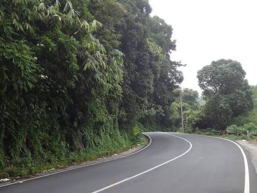
| Key challenge | Charmady Ghat section — narrow, environmentally restricted widening |
Where This Corridor Actually Runs Today
The route begins at Mangaluru on Karnataka’s coast and runs east through the Western Ghats, across Karnataka’s interior, briefly touching Andhra Pradesh, and finally through Tamil Nadu to Viluppuram. Under the current system, this single journey requires transitioning across four separate highway numbers in sequence — NH 73 covers the first stretch through the ghats to Banavara, NH 69 continues from Banavara to Mulbagal, NH 75 carries the route from Mulbagal through to Vellore, and finally NH 38 completes the journey from Vellore to Viluppuram.
This fragmentation reflects how the 2010 renumbering prioritized creating more logical, directionally consistent highway networks over preserving historical single-route designations — even where, as here, it meant splitting one continuous corridor into four numbered pieces.
The Route Through Three States
Leaving Mangaluru, the corridor passes through Bantwal and Belthangady before entering the Charmady Ghat section of the Western Ghats — the same challenging, narrow stretch covered in this series’ NH 73 article. Continuing east, the route passes through Mudigere, Belur, and Huliyar before reaching Sira and Madhugiri in Karnataka’s interior.
From here, the corridor continues through Gauribidanur and Chintamani before briefly touching Andhra Pradesh near Venkatagirikota. Re-entering Tamil Nadu, the route passes through Pernampattu, Gudiyatham, and reaches Vellore, a significant city known for its fort and medical education institutions. From Vellore, the highway continues through Polur and Thiruvannamalai — a major pilgrimage town centred around the Arunachaleswarar Temple — before finally reaching Viluppuram.
The Charmady Ghat: A Recurring Challenge Along This Route
As with NH 73 covered separately, the Charmady Ghat section near the start of this corridor remains one of its most persistent challenges. Forest department restrictions on road widening through this stretch of the Western Ghats have limited infrastructure development for years, and there have been long-standing proposals — echoing similar discussions for the Shiradi Ghat on NH 75 — to build a tunnel through this section rather than pursuing surface widening, given the environmental sensitivity of the terrain.
Such a tunnel, if built, would meaningfully reduce travel time and also provide an important alternative route for large trucks moving materials to Mangaluru’s seaport and air-cargo facilities — though as of the most recent updates, this remains a proposal rather than a committed, funded project.
Thiruvannamalai and Vellore: Genuine Destinations Along the Way
This corridor passes through two towns of real significance beyond their role as waypoints. Thiruvannamalai draws substantial pilgrimage traffic given its association with the Arunachaleswarar Temple and its status as one of Tamil Nadu’s most visited spiritual destinations, particularly during the Karthigai Deepam festival. Vellore, meanwhile, is known both for its historic fort and for hosting major medical education institutions that draw students and patients from across India, adding a distinct commercial and educational traffic pattern to this stretch of the route.
Why This Corridor Matters Economically
Beyond its historical unity, this route connects Mangaluru’s port economy to Karnataka’s interior agricultural belt, briefly touches Andhra Pradesh’s border regions, and finally reaches into Tamil Nadu’s northern industrial and educational hubs around Vellore. For freight moving between Mangaluru’s coastal trade infrastructure and Tamil Nadu’s interior markets, this corridor — even split across four highway numbers — remains a practically important route.
Road Conditions: What to Actually Expect
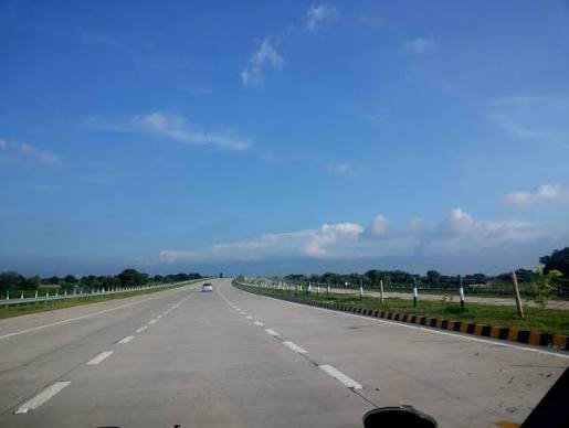
Given the corridor’s fragmentation and varying development histories across its four current designations, road conditions differ considerably by stretch. The Charmady Ghat portion within NH 73 remains narrow and challenging. The Karnataka interior stretch through Sira and Madhugiri (NH 69) is generally more developed given flatter terrain. The Tamil Nadu portion through Vellore and Thiruvannamalai (NH 38 and part of NH 75) tends to see heavier traffic given the population density and pilgrimage activity these towns generate.
Speed Limits and Driving Considerations
Standard national highway limits apply on developed stretches — up to 100 km/h for cars — but this drops considerably through the Charmady Ghat section given its narrow, winding character. Elsewhere, particularly through Karnataka’s flatter interior districts, more consistent higher speeds are achievable, though congestion around Vellore and Thiruvannamalai can slow travel regardless of posted limits, especially during pilgrimage seasons.
Challan Rules Across the Route
Standard Motor Vehicles Act penalties apply across Karnataka, Andhra Pradesh, and Tamil Nadu, with overspeeding fines typically in the ₹1,000-₹4,000 range depending on vehicle category, with each state setting its own specific rates within that framework. Given that this journey now technically crosses four separate highway jurisdictions, enforcement approaches and camera coverage can vary meaningfully as you move between each numbered segment.
FAQs
Q1. Why can’t I find “NH 234” anywhere on current highway maps?
Because this designation no longer exists as an active highway number. The original Mangaluru-Viluppuram route was split into four separate highways — NH 73, NH 69, NH 75, and NH 38 — during the 2010 renumbering, and “NH 234” simply isn’t in current use for this corridor.
Q2. Do I need to navigate separately for each of the four highway segments, or does the road stay continuous?
The physical road stays continuous — you’re driving one connected route regardless of the numbering changes. The four different designations matter mainly for official reference, signage, and administrative purposes rather than requiring you to change roads at each transition point.
Q3. Is a tunnel through Charmady Ghat actually being built, or is this just a proposal?
As of the most recent available information, this remains a proposal rather than a funded, active project. If reducing travel time through this specific stretch is important for your planning, don’t assume the tunnel exists yet — check current infrastructure status before relying on it.
Q4. Which stretch of this corridor sees the heaviest pilgrimage and tourist traffic?
The approach to and through Thiruvannamalai, given its status as a major Tamil Nadu pilgrimage destination. Expect noticeably heavier traffic during major festival periods like Karthigai Deepam, and plan extra time through this section accordingly.