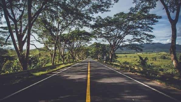
Unlike most highways on this list, NH 13 doesn’t cross state boundaries at all — it runs entirely within Arunachal Pradesh, yet at roughly 1,559 km, it’s still one of the longer national highways in the country. Known as the core of the Trans-Arunachal Highway network, it connects Tawang in the state’s northwest, close to the Bhutan and Tibet borders, all the way to Wakro in the southeast near the Assam border, cutting through some of India’s most remote and strategically significant terrain.
NH 13 Quick Facts
| Detail | Information |
| Starting point | Tawang, Arunachal Pradesh |
| Ending point | Wakro, Lohit district, Arunachal Pradesh |
| Total length | Approximately 1,559 km (some sources cite 1,293 km for a shorter measurement) |
| States covered | 1 — entirely within Arunachal Pradesh |
| Former name | Old NH 229 and NH 52 |
| Also known as | Core stretch of the Trans-Arunachal Highway |
| Highway type | Two-lane throughout |
| Key infrastructure | Sela Tunnel (bypasses Sela Pass); Dibang River Bridge (completed 2018) |
| Speed limit | 100 km/h (cars), 90 km/h (larger passenger vehicles), 80 km/h (goods vehicles) — largely theoretical given terrain |
| Major towns linked | Bomdila, Ziro, Daporijo, Along, Pasighat, Tezu |
Where NH 13 Starts and Ends
NH 13 begins at Tawang, a high-altitude town near the India-China border famous for its centuries-old Buddhist monastery, and terminates at Wakro in Lohit district, close to Arunachal Pradesh’s border with Assam, where it connects to NH 15. Unlike virtually every other highway covered in this series, NH 13 never leaves its home state — the entire 1,559-km route runs within Arunachal Pradesh, a reflection of just how vast and geographically complex this single state actually is.
The full route became fully operational only in 2018, following completion of the 6.2-km Dibang River Bridge — a milestone that finally connected sections of the highway that had previously existed in fragments.
The Route Through Arunachal Pradesh
From Tawang, NH 13 descends through Bomdila and Nechipu before continuing to Seppa and Sagalie. This western stretch traverses genuinely high-altitude terrain, historically dependent on Sela Pass — a route notorious for snow closures during winter months.
Continuing east, the highway reaches Ziro, home to the Apatani tribal community and known for its distinctive valley landscape, before passing through Daporijo and Along. This central stretch links some of Arunachal Pradesh’s most culturally distinct districts, each with its own tribal heritage and traditions that the highway has helped connect to broader trade and administrative networks.
From Along, NH 13 continues through Pasighat — one of the oldest towns in the state — before reaching Tezu and finally terminating at Wakro, where it joins NH 15 for onward connectivity toward Assam.
The Sela Tunnel: A Genuine Game-Changer for This Route
Before recent infrastructure work, reaching Tawang from the rest of the highway meant crossing Sela Pass, a high-altitude route prone to heavy snowfall and seasonal closures that could cut off the region for extended periods each winter. The Sela Tunnel was built specifically to address this, providing an all-weather alternative that bypasses the pass entirely.
This matters enormously for anyone planning travel to or from Tawang specifically — a region that, before this tunnel, faced genuine connectivity challenges during winter months regardless of the rest of the highway’s condition. With the tunnel operational, Tawang’s accessibility has fundamentally improved, though travellers should still verify current conditions before winter travel given the broader region’s weather variability.
Why This Highway Matters Strategically
NH 13’s significance extends well beyond ordinary connectivity. Given its proximity to the Line of Actual Control opposite China’s Western Theater Command in India’s eastern sector, this highway carries genuine strategic weight for the Indian military’s ability to move personnel and resources through the region. That’s part of why sustained investment in this route — including bridges, tunnels, and ongoing widening work — has continued even though it serves a relatively sparse population compared to highways in more densely settled states.
Beyond defence considerations, the highway has meaningfully opened up remote districts for trade, healthcare access, education, and tourism, integrating communities that were previously isolated by extremely difficult terrain.
Road Conditions: What to Genuinely Expect
This is not a highway to underestimate. NH 13 is described consistently as a challenging drive — steep inclines, narrow two-lane sections throughout, and frequent landslide risk given the mountainous terrain it cuts through. The scenery is genuinely spectacular, with snow-capped peaks, dense forest, and waterfalls along much of the route, but this comes paired with real driving demands that shouldn’t be taken lightly.
Typical single-leg travel times on sections of this highway run around 8 hours, though this varies considerably based on road conditions, weather, and the specific stretch involved — this isn’t a highway where you can reliably estimate travel time using distance and speed limit alone.
Speed Limits and Practical Driving Notes
Standard highway speed limits technically apply — up to 100 km/h for cars — but given the terrain, these figures are largely theoretical for most of NH 13’s length. Narrow two-lane sections, steep gradients, and landslide-prone stretches mean actual safe speeds run well below posted maximums for the majority of the route, particularly through the western high-altitude sections near Tawang and Bomdila.
FAQs
Q1. Has the Sela Tunnel actually solved the winter accessibility problem for Tawang?
It’s made a significant difference by providing an all-weather bypass around Sela Pass, which previously faced heavy snow closures. That said, the broader region still experiences challenging winter weather, so checking current conditions before planning winter travel to Tawang remains sensible rather than assuming year-round ease of access.
Q2. Why do length figures for NH 13 vary between roughly 1,293 km and 1,559 km?
The difference generally reflects measurement changes following the 2018 completion of the full route, including the Dibang River Bridge connection. The more current and complete figure, reflecting the fully operational highway, is approximately 1,559 km.
Q3. Is NH 13 a realistic route for a tourist road trip, or is it mainly for local and strategic use?
Both, genuinely. The highway does see meaningful tourism traffic given destinations like Tawang Monastery, Ziro Valley, and Bomdila along the route, but the challenging terrain means it demands more careful planning than a typical highway road trip — building in extra travel time and checking road conditions section by section matters here.
Q4. What should I know about landslide risk before planning a trip on NH 13?
Landslide risk is a genuine and recurring concern given the highway’s mountainous terrain, particularly during monsoon season. Checking current road status through Arunachal Pradesh’s PWD or district administration channels before departure is worth the effort, and building flexibility into your itinerary is wise rather than optional on this route.