Four northeastern states, two state capitals, and terrain that shifts from Assam’s tea gardens to Mizoram’s hill country — NH 2 is arguably the most important connecting artery for India’s northeast. Running 1,325.6 km from Dibrugarh in Assam down to Tuipang in Mizoram, it links Nagaland’s Kohima and Manipur’s Imphal along a single continuous highway, something that wasn’t even possible under the old numbering system before 2010.
If you’re researching NH 2’s exact route, length, speed limits, or what a traffic violation actually costs on this stretch, here’s the full, current picture.
NH 2 Quick Facts
| Detail | Information |
| Starting point | Junction with NH 15, near Dibrugarh, Assam |
| Ending point | Tuipang, Mizoram |
| Total length | Approximately 1,325.6 km |
| States covered | 4 — Assam, Nagaland, Manipur, Mizoram |
| Formed from | Old NH 37, NH 61, NH 39, NH 150, and NH 54 (merged in 2010) |
| Maintained by | National Highways Authority of India (NHAI) |
| State capitals linked | Kohima (Nagaland), Imphal (Manipur) |
| Highway type | Largely two-lane, hilly terrain for much of its length |
| Speed limit | 100 km/h (cars) on open stretches; significantly lower through hill sections |
| Overspeeding fine | ₹1,000-₹4,000 range under the Motor Vehicles (Amendment) Act, varying by vehicle type and state |
Where NH 2 Begins and Ends
NH 2 starts at its junction with NH 15 close to Dibrugarh, a major city in Upper Assam known for tea, oil, and its position as a gateway to the northeast’s interior. From there, the highway runs south through increasingly hilly terrain, finally ending at Tuipang — a small town in Mizoram near the Myanmar border, marking one of India’s more remote highway termini.
This isn’t a route most people drive end to end for practical purposes. It’s better understood as the connective spine that links four separate northeastern states into a single road corridor, something that mattered a great deal when NHAI consolidated five disconnected older highways into this one continuous designation back in 2010.
The Route Through Four States
Leaving Dibrugarh, NH 2 passes through Sivasagar, Jhanji, and Amguri while still in Assam — a stretch through the state’s tea-growing heartland. Crossing into Nagaland, the highway climbs through Mokokchung and Wokha before reaching Kohima, the state capital, sitting at a considerable elevation in the hills.
From Kohima, NH 2 descends into Manipur, running through Imphal, the state capital, and continuing to Churachandpur. This Manipur stretch has, in recent years, experienced periods of disruption tied to regional unrest — travellers planning to use this section should check current advisories before departure rather than assuming unrestricted access.
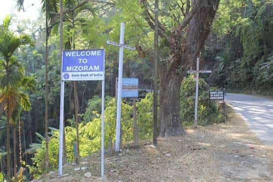
Entering Mizoram, the highway passes through Seling, Serchhip, and Lawngtlai before reaching its final terminus at Tuipang — genuinely one of the more remote and scenic stretches on the entire route, cutting through Mizoram’s characteristic hill terrain.
Speed Limits: What to Actually Expect
Standard national highway speed limits technically apply on NH 2 — up to 100 km/h for cars on open stretches — but this figure is largely theoretical for most of the route. Given how much of NH 2 runs through hilly and mountainous terrain in Nagaland, Manipur, and Mizoram, actual safe driving speeds are considerably lower than the posted highway maximum for long stretches.
Local speed limit boards should always take precedence over general highway defaults, and this matters more on NH 2 than on flatter highways elsewhere in India — hill sections here involve sharp curves, narrow carriageways, and frequent elevation changes that make consistent high-speed driving neither realistic nor safe.
Challan and Traffic Fine Rules on NH 2
Traffic enforcement across Assam, Nagaland, Manipur, and Mizoram follows the same central Motor Vehicles Act framework as the rest of India, with overspeeding fines generally falling between ₹1,000 and ₹4,000 depending on vehicle category — light motor vehicles at the lower end, medium and heavy vehicles higher. States retain authority to notify their own specific rates within these central guidelines, so the exact figure can vary slightly as you cross from one state to another along this route.
ANPR camera enforcement is far less dense on NH 2 compared to highways in states like UP, Gujarat, or Maharashtra, given the terrain and lower traffic volume — but that doesn’t mean lower risk. Hill roads with sharp curves and reduced visibility carry genuine accident risk regardless of camera coverage, so treating the posted limits as a ceiling rather than a target matters here more than most places.
Why This Highway Matters for the Northeast
NH 2’s real significance lies in what it enabled after the 2010 renumbering: a single, continuous highway designation connecting four states that previously relied on a patchwork of disconnected older routes. For a region historically underserved by road infrastructure compared to the rest of India, that consolidation mattered for freight movement, defence logistics, and basic connectivity between state capitals.
The highway also plays a strategic role given its proximity to India’s borders with Myanmar, supporting movement of goods and personnel through a geographically challenging part of the country.
Road Conditions and Travel Advisory
Given the hill terrain across most of its length, NH 2 sees ongoing widening and strengthening work under various phases of NHDP-linked northeast connectivity projects. Conditions vary considerably by stretch — the Assam plains section is generally smoother, while the Nagaland, Manipur, and Mizoram hill portions can involve narrower roads, landslide risk during monsoon, and periodic maintenance closures.
Given recent periods of regional disruption in parts of Manipur, it’s genuinely worth checking current travel advisories for that specific stretch before planning a trip through this section, rather than assuming conditions match the rest of the route.
FAQs
Q1. Is NH 2 the same as the old Delhi-Kolkata highway also once called NH 2?
No, and this is a common point of confusion. The pre-2010 NH 2 referred to the Delhi-Kolkata route, which is now designated NH 19. The current NH 2 is an entirely different highway in the northeast, connecting Dibrugarh to Tuipang.
Q2. What’s the safest way to plan a long drive on NH 2 through the hill states?
Break the journey into shorter daily legs rather than attempting long single-day drives, given the terrain. Daylight driving is strongly preferable through the Nagaland, Manipur, and Mizoram hill sections, and checking current road and regional advisories before departure is worth doing for each state stretch individually.
Q3. Does NH 2 connect both Kohima and Imphal directly?
Yes — both state capitals sit directly on the route, making NH 2 the primary highway link between Nagaland and Manipur’s administrative centres, and onward toward Mizoram.
Q4. How do overspeeding fines differ across the four states NH 2 passes through?
While the central Motor Vehicles Act sets the overall ₹1,000-₹4,000 framework, Assam, Nagaland, Manipur, and Mizoram each notify their own specific amounts within that range. If you’re driving the full route, expect the exact fine for the same violation to shift slightly as you cross state lines.