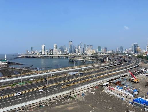
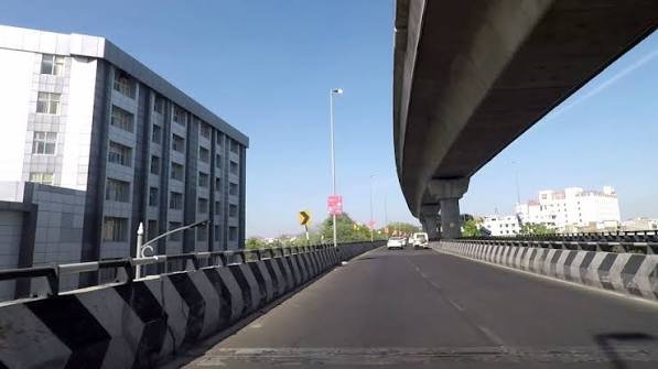
Officially named the Acharya Tulsi Setu, the Jaipur Elevated Road is a compact but genuinely useful piece of urban infrastructure that helps ease traffic movement through one of Rajasthan’s busiest city corridors. At 4.5 km, this elevated stretch connects Gopal Wadi Bus Stand to Vidhyut Nagar, giving Jaipur commuters a faster alternative to navigating the city’s dense surface-level traffic.
Here’s what’s confirmed about this elevated road’s route and role within Jaipur’s broader transport network, alongside the regional highway infrastructure that connects to it.
Jaipur Elevated Road Quick Facts
| Detail | Information |
| Official name | Acharya Tulsi Setu |
| Also known as | Jaipur Elevated Road |
| Starting point | Gopal Wadi Bus Stand |
| Ending point | Vidhyut Nagar |
| Total length | 4.5 km |
| Location | Jaipur, Rajasthan |
| Type | Urban elevated road |
| Opened | 2014 |
Where the Elevated Road Runs
The Jaipur Elevated Road connects Gopal Wadi Bus Stand to Vidhyut Nagar, providing a direct, elevated route through a section of the city that would otherwise involve navigating dense surface-level traffic.
Key route facts:
- Total length: 4.5 km
- Officially named Acharya Tulsi Setu
- Opened to public traffic in 2014
- Functions as a compact urban elevated corridor rather than a long-distance highway
Why This Elevated Road Matters for Jaipur
Compact elevated roads like this one exist specifically to solve localized but genuinely significant urban congestion problems, connecting two important city points without requiring commuters to navigate the surface streets between them.
Core purpose:
- Provides a faster, largely uninterrupted route between Gopal Wadi Bus Stand and Vidhyut Nagar
- Reduces reliance on congested surface roads in this stretch of the city
- Reflects Jaipur’s broader push, alongside projects like the Jaipur Ring Road, to modernize urban traffic infrastructure as the city has grown
Jaipur’s Broader Highway and Ring Road Context
While the Acharya Tulsi Setu addresses a specific city-level connectivity need, Jaipur’s growth has been supported by considerably larger infrastructure projects worth understanding for context.
Jaipur Ring Road:
- 147-km ring road encircling the city, built by the Jaipur Development Authority (JDA)
- Designed for speeds up to 120 km/h
- Phase I & II: 47 km in southern Jaipur, connecting Ajmer Road, Tonk Road, and Agra Road
- Phase III: 97.75 km in northern Jaipur, connecting Agra Road, Delhi Road, Sikar Road, and Ajmer Road
- Construction contract valued at ₹900 crore, awarded to Sanjose-Supreme in May 2011
- Envisioned as a toll-free, signal-free, six-lane access-controlled expressway with three-lane service roads on both sides
- Project faced delays due to a deadlock between JDA and farmers over land acquisition compensation
The Jaipur-Kishangarh Expressway: Regional Connectivity
Beyond the city’s internal road network, Jaipur connects to the rest of Rajasthan and India’s Golden Quadrilateral network through a significant regional expressway.
Jaipur-Kishangarh Expressway details:
- 90-km access-controlled toll expressway connecting Jaipur to Kishangarh
- Forms a segment of NH-48, part of the Golden Quadrilateral project under the National Highway Development Project
- Six-lane expressway, inaugurated in April 2005
- Provides Jaipur’s primary fast connection toward Ajmer and onward destinations
Jaipur to Ajmer: A Common Regional Route
Given Jaipur’s position as Rajasthan’s capital and its proximity to Ajmer, one of the state’s most visited pilgrimage destinations, this route sees substantial regular traffic worth understanding for travellers.
Route details:
- Distance via NH-48: approximately 133-135 km
- Typical travel time: 2.5-3 hours by car
- 2 toll plazas along the route
- Total toll cost: approximately ₹170 for cars/sedans, ₹275 for SUVs
- All toll plazas accept FASTag for faster, contactless payment
- Road condition is generally well-maintained, suitable for families, tourists, and pilgrims visiting Ajmer Sharif Dargah
Practical Travel Tips for Jaipur-Ajmer Journeys
Given how commonly this route is travelled, particularly by pilgrims and tourists, a few practical considerations genuinely improve the journey experience.
Useful travel guidance:
- Start early morning to avoid city congestion before reaching the highway
- Keep FASTag active and topped up to avoid delays at toll plazas
- Carry water, food, and basic supplies, particularly given Rajasthan’s high summer temperatures
- Avoid travelling during peak summer afternoons given extreme heat
- Best travel months: October through February, when weather conditions are considerably more comfortable
Broader Regional Highway Development Around Jaipur
Jaipur’s connectivity continues to expand through several larger regional projects currently under construction or in planning stages.
Notable regional projects:
- Ludhiana-Bathinda-Ajmer Expressway — a 600-km, six-lane (expandable to eight) under-construction corridor connecting Ludhiana through Bathinda to Ajmer, part of the Ludhiana-Ajmer Economic Corridor
- Jodhpur Ring Road — a 126.688-km project connecting highways surrounding Jaipur, Nagaur, Jaisalmer, Barmer, and Pali
- These projects reflect Rajasthan’s broader investment in strengthening highway connectivity across the state’s major cities
FAQs
Q1. Is the Jaipur Elevated Road (Acharya Tulsi Setu) tolled?
No toll information is publicly associated with this urban elevated road — it functions as a city-level connector rather than a tolled highway, unlike the regional expressways connecting Jaipur to other cities.
Q2. How is the Jaipur Elevated Road different from the Jaipur Ring Road?
They serve entirely different purposes and scales. The Elevated Road is a compact 4.5-km urban corridor connecting two specific points within the city, while the Jaipur Ring Road is a much larger 147-km project designed to route through-traffic around the city’s periphery entirely.
Q3. What’s the best way to budget for tolls if I’m driving from Jaipur to Ajmer?
Budget approximately ₹170 for a car or ₹275 for an SUV across the two toll plazas on this 133-135 km route via NH-48. Ensure your FASTag is active beforehand, since all plazas on this stretch use FASTag for faster processing.
Q4. When is the best time to drive from Jaipur toward Ajmer or other regional destinations?
October through February offers the most comfortable travel conditions given Rajasthan’s extreme summer heat. If summer travel is unavoidable, start early morning and avoid afternoon departures, and carry adequate water and supplies for the journey.