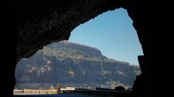
Here’s an important clarification before the route details: the corridor once known as NH 217, connecting the Chhattisgarh border through Odisha’s interior to the Bay of Bengal coast near Gopalpur, no longer carries that number. Following India’s 2010 highway renumbering, this route was split into two separate designations — NH 353 for the western Chhattisgarh-border-to-Khariar stretch, and NH 59 for the main Khariar-to-Brahmapur (Berhampur) corridor, which historically continued on to Gopalpur. The current NH 217 is an unrelated highway located entirely in Assam and Meghalaya.
Route Quick Facts (Historically NH 217, Now NH 353 and NH 59)
| Detail | Information |
| Historical starting point | Chhattisgarh border, near Raipur direction |
| Historical ending point | Gopalpur, Odisha (Bay of Bengal coast) |
| Original combined length | Approximately 431-438 km |
| Current designations | NH 353 (Chhattisgarh border to Khariar) and NH 59 (Khariar to Brahmapur/Berhampur) |
| NH 59 length | Approximately 351 km |
| States covered | Chhattisgarh, Odisha |
| Districts crossed (Odisha) | Nuapada, Balangir, Kandhamal, Ganjam |
| Maintained by | National Highways Authority of India (NHAI) |
| Major towns linked | Nuapada, Khariar, Titlagarh, Baliguda, Brahmapur |
| Speed limit | 100 km/h (cars) on developed stretches; lower through hilly Kandhamal sections |
Where This Corridor Actually Runs
The route begins near the Chhattisgarh border and heads into Odisha’s Nuapada district, passing through Khariar before continuing through Balangir district via Titlagarh. From there, it enters the hillier Kandhamal district, running through Baliguda, before descending toward the coastal plains and reaching Brahmapur (Berhampur) in Ganjam district, close to Gopalpur.
Under the current system, the western portion from the Chhattisgarh border to Khariar is designated NH 353, while the main stretch from Khariar through Titlagarh, Baliguda, Sorada, and Asika to Brahmapur — where it meets NH 16 — is NH 59. Gopalpur itself, a small coastal town near Brahmapur, connects via short local highway spurs rather than being the direct terminus of either current designation.
The Route Through Western and Southern Odisha
Leaving the Chhattisgarh border area, the corridor passes through Nuapada and reaches Khariar, a significant junction point where the current NH 353 and NH 59 designations meet. Continuing east, the route runs through Titlagarh in Balangir district — a town known for its notably extreme summer temperatures, among the hottest recorded in the region.
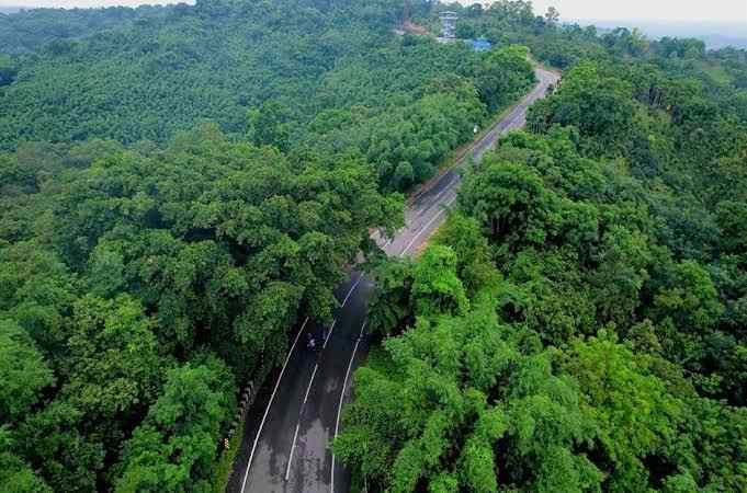
From Titlagarh, the highway continues into Kandhamal district, passing through Baliguda before reaching Sorada and Asika in Ganjam district. This stretch through Kandhamal involves genuinely hilly, forested terrain, distinct from the flatter western Odisha districts the route begins in. From Asika, the corridor continues to Brahmapur, one of Odisha’s significant coastal cities, close to Gopalpur’s beaches and port.
Why This Corridor Matters Economically
This route serves as a critical connector between Odisha’s mineral-rich and agricultural western districts and its coastal economic centres. It facilitates the movement of agricultural produce, minerals, and industrial goods from resource-rich interior regions toward Bay of Bengal port access near Gopalpur and Brahmapur, supporting broader economic integration between Odisha’s inland and coastal zones.
Given that portions of this corridor pass through districts historically affected by Naxal activity, particularly in the western stretches, this highway has also carried strategic and security significance for regional administration and connectivity, beyond its purely commercial role.
Titlagarh: A Notably Extreme Climate Stop
Worth mentioning specifically: Titlagarh, a significant town along this route, has historically recorded some of the highest temperatures in the region during peak summer months. Travellers planning to drive through this stretch during April through June should factor in genuinely extreme heat conditions, adjusting travel timing and vehicle preparation accordingly.
Road Conditions Along the Route
Given the corridor’s split into two current designations with different development histories, road conditions vary by stretch. The western NH 353 portion near the Chhattisgarh border tends to see less traffic density given the more remote terrain. The NH 59 stretch through Titlagarh, Baliguda, and onward to Brahmapur has seen more consistent development given the larger towns and coastal connectivity it supports, though the hillier Kandhamal district section still demands more cautious driving than the flatter stretches on either end.
Speed Limits and Driving Considerations
Standard national highway limits apply on developed stretches — up to 100 km/h for cars — but this drops meaningfully through the Kandhamal hill district, where terrain and road curvature naturally limit safe driving speeds. The extreme summer heat around Titlagarh also warrants practical driving adjustments — frequent hydration breaks and avoiding peak midday travel where possible during the hottest months.
Challan Rules Across Both States
Standard Motor Vehicles Act penalties apply in both Chhattisgarh and Odisha, with overspeeding fines typically in the ₹1,000-₹4,000 range depending on vehicle category, with each state setting its own specific rates within that framework. Given the corridor’s mix of remote western stretches and more developed coastal-approach sections near Brahmapur, enforcement intensity naturally varies, with more consistent monitoring around the larger towns compared to the sparser interior portions.
FAQs
Q. Why can’t I find “NH 217” between Raipur and Gopalpur on current maps?
Because that designation was retired for this corridor during the 2010 national highway renumbering. It’s now split between NH 353 (western portion) and NH 59 (main Khariar-to-Brahmapur stretch). Older references and some regional government documents still use the “NH 217” name, which is why the discrepancy persists.
Q. Why is Titlagarh known for such extreme heat, and how should I plan around it?
Titlagarh’s interior location and terrain contribute to some of the highest recorded summer temperatures in the region, particularly between April and June. If your travel dates fall in this window, plan for early morning or evening driving through this stretch, and carry extra water and vehicle cooling precautions.
Q. Is the Kandhamal district stretch of this route safe and well-maintained?
The hillier Kandhamal section, particularly around Baliguda, involves more demanding terrain than the flatter western and coastal portions of the route. It’s generally passable but requires more cautious driving; checking current road status before travel, especially during monsoon season, is advisable given the district’s forested, hilly geography.
Q. Does this route provide direct access to Gopalpur’s beaches from Chhattisgarh?
Yes, functionally — the corridor via NH 353 and NH 59 gets you to Brahmapur, from which short local roads and highway spurs connect to Gopalpur itself. It remains a practical route for reaching this coastal destination from Chhattisgarh, even though the official through-designation has changed.