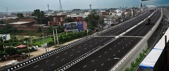
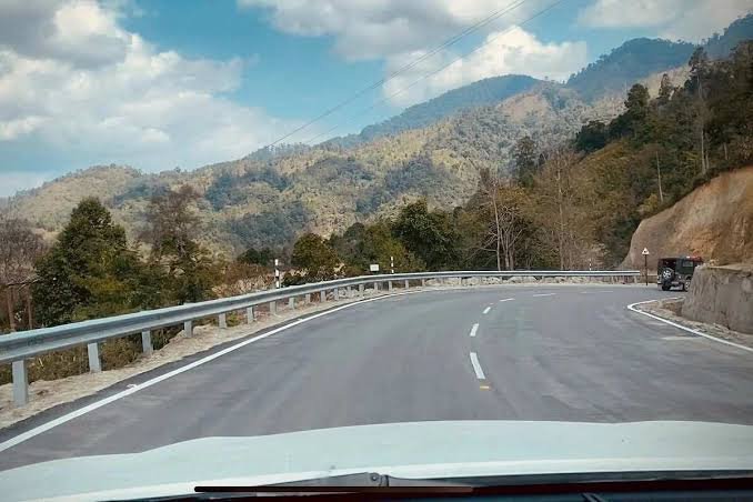
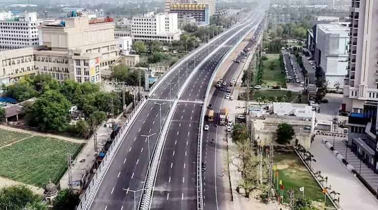
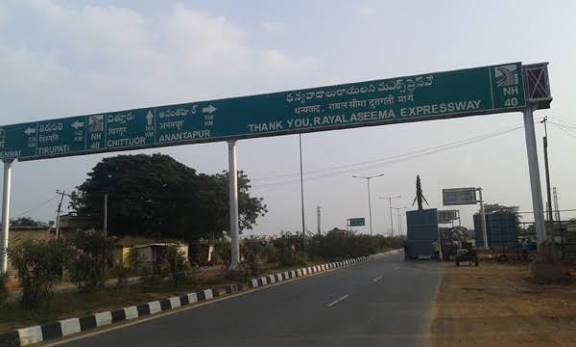
Known locally as the Rayalaseema Express Highway, NH 40 covers roughly 411 km connecting Kurnool in Andhra Pradesh’s interior to Ranipet in Tamil Nadu, cutting straight through the historically significant Rayalaseema region. It’s not one of India’s longest or most famous highways, but it plays an outsized role for the districts it passes through, linking agricultural heartland to Tamil Nadu’s industrial belt.
Here’s the complete, accurate breakdown of this highway’s route, length, and current development status.
NH 40 Quick Facts
| Detail | Information |
| Starting point | Kurnool, Andhra Pradesh (junction with NH 44) |
| Ending point | Ranipet, Tamil Nadu (junction with NH 48) |
| Total length | Approximately 411 km (some sources cite 408-420 km) |
| State-wise split | Around 381 km in Andhra Pradesh, 30 km in Tamil Nadu |
| Local name | Rayalaseema Express Highway |
| Formed from | Old NH 4 and NH 18, merged |
| Maintained by | National Highways Authority of India (NHAI) |
| Major towns linked | Nandyal, Kadapa, Rayachoti, Chittoor |
| Speed limit | 100 km/h (cars), 90 km/h (larger passenger vehicles), 80 km/h (goods vehicles) |
| Typical travel time | Around 7 hours end to end |
Where NH 40 Starts and Ends
NH 40 begins at Kurnool, at its junction with NH 44, and runs south through Andhra Pradesh’s Rayalaseema region before crossing into Tamil Nadu and terminating at Ranipet, where it meets NH 48. This makes NH 40 a genuinely useful connector highway — it links the north-south backbone of NH 44 to the east-west corridor of NH 48, giving travellers and freight operators an alternative diagonal route through this part of southern India.
Given that roughly 93% of the highway’s length sits within Andhra Pradesh, NH 40 functions primarily as an internal Rayalaseema corridor that happens to extend just across the state border into Tamil Nadu.
The Route Through Rayalaseema and Into Tamil Nadu
Leaving Kurnool, NH 40 passes through Nandyal and Allagadda before reaching Mydukur and Kadapa — one of the more significant towns along this route and a district headquarters in its own right. From Kadapa, the highway continues through Rayachoti and Pileru before reaching Chittoor, a district that shares a border with Tamil Nadu.
Crossing into Tamil Nadu, NH 40 covers a comparatively short final stretch before reaching Ranipet, terminating at its junction with NH 48.
This entire route passes through Andhra Pradesh’s Rayalaseema region — historically distinct from the state’s coastal districts, with its own agricultural patterns, terrain, and cultural identity, shaped significantly by its semi-arid climate and proximity to the Eastern Ghats.
Four-Laning Progress: What’s Done and What’s Still Coming
NH 40 has seen substantial infrastructure investment over the past decade, and it’s worth knowing exactly where things currently stand if you’re planning to drive this route. The 188.75-km stretch between Kurnool and Kadapa was fully converted from a two-lane to a four-lane divided highway under Phase III of the National Highways Development Project, with that specific project finalized on July 1, 2022 — meaning this segment now offers considerably smoother, safer driving than the highway’s older configuration.
Further south, the Rayachoti-Ranipet section — spanning the approach to and across the Tamil Nadu border — has been under active development, with the foundation stone laid in April 2025 for remaining stretches passing through Palamaneru and Punganur toward the state border. This means travellers on the southern portion of NH 40 should currently expect a mix of completed four-lane sections and areas still undergoing construction or awaiting upgrade work.
Why This Highway Matters for Rayalaseema
NH 40 serves as a critical freight and passenger corridor connecting Rayalaseema’s agricultural and industrial centres to Tamil Nadu’s broader economic network via Ranipet and onward through NH 48. For a region historically seen as less economically developed compared to Andhra Pradesh’s coastal belt, this highway represents meaningful connectivity infrastructure — supporting the movement of agricultural produce, and increasingly, industrial goods as development continues along the corridor.
Kadapa and Chittoor, both significant stops along the route, have seen growing commercial activity partly linked to improved highway access, reflecting a broader pattern of infrastructure-driven development in this part of Andhra Pradesh.
Road Conditions: What to Actually Expect
Given the phased four-laning work, road quality on NH 40 varies noticeably depending on which stretch you’re driving. The Kurnool-Kadapa section, now fully four-lane, offers smooth, modern highway conditions. South of Kadapa toward Rayachoti and onward to the Tamil Nadu border, expect more variation — some sections upgraded, others still on older two-lane configuration pending the ongoing project work initiated in 2025.
The terrain itself shifts from relatively flat agricultural plains near Kurnool to more undulating landscape as the highway approaches the Eastern Ghats near Chittoor, which can affect driving conditions and typical speeds on that stretch regardless of lane configuration.
Speed Limits and Safety Notes
Standard national highway limits apply — up to 100 km/h for cars, 90 km/h for larger passenger vehicles, and 80 km/h for goods vehicles on developed stretches. Given the mix of completed and under-construction sections, it’s worth treating posted limits as maximums rather than defaults, particularly on the southern stretch where active construction work may still be affecting road conditions.
Standard highway safety guidance applies throughout: avoid overtaking on curves or narrow sections, maintain safe following distances especially during monsoon season, and use headlights during daytime given the mix of terrain and visibility conditions along the route.
Challan Rules on NH 40
Standard Motor Vehicles Act penalties apply across both Andhra Pradesh and Tamil Nadu, with overspeeding fines typically in the ₹1,000-₹4,000 range depending on vehicle category, with each state setting its own specific rates within that framework. Given the highway’s ongoing construction activity on certain stretches, enforcement near active project zones often focuses on speed compliance around temporary diversions and reduced-speed work areas as much as standard highway monitoring.
FAQs
Q1. Is the entire NH 40 route now four-lane, or should I expect mixed conditions?
Expect mixed conditions currently. The Kurnool-Kadapa stretch is fully four-lane as of 2022, but the Rayachoti-Ranipet section, including the approach to Tamil Nadu, has ongoing upgrade work initiated in 2025 — meaning some portions remain on older two-lane configuration for now.
Q2. How long does the full Kurnool-to-Ranipet drive typically take?
Around 7 hours under normal conditions, though this can vary depending on which stretches you encounter under active construction and general traffic and weather conditions on the day.
Q3. Why is NH 40 called the Rayalaseema Express Highway if it’s not fully expressway-standard yet?
The name reflects the highway’s role and ambition as the primary express corridor for the Rayalaseema region, even though full four-lane conversion across its entire length is still a work in progress. The completed Kurnool-Kadapa stretch does deliver genuine expressway-level driving conditions.
Q4. Does NH 40 provide a useful alternative route between NH 44 and NH 48 for longer trips?
Yes — that’s essentially its core function. If you’re travelling between these two major highways and want a more direct diagonal route through the Rayalaseema region rather than a longer detour via other corridors, NH 40 serves that purpose effectively, particularly now that its northern stretch is fully upgraded.