Until fairly recently, reaching Zanskar Valley from Kargil meant a genuinely arduous journey over largely unpaved mountain terrain — cut off from the rest of Ladakh for much of the year by snow. NH 301 is changing that. Running roughly 234 km, this highway connects Kargil to Padum, the administrative headquarters of Zanskar, following the Suru and Stod river valleys through some of the most remote and dramatic terrain in the Indian Himalayas.
NH 301 Quick Facts
| Detail | Information |
| Starting point | Kargil, Ladakh (junction with NH 1) |
| Ending point | Padum, Zanskar Valley (junction with Nimmu-Padum-Darcha road) |
| Total length | Approximately 230-234 km |
| Union territory | Entirely within Ladakh |
| Declared national highway | 2017 |
| Maintained by | National Highways and Infrastructure Development Corporation Limited (NHIDCL) |
| Highway type | Intermediate-lane, currently under phased upgrade |
| Key valleys traversed | Suru Valley, Stod (Doda) Valley |
| Major pass crossed | Pensi La (Penzi La) |
| Speed limit | Generally low and terrain-dependent; no consistent high-speed sections |
Where NH 301 Begins and Ends
NH 301 starts at Kargil, at its junction with NH 1 (the Srinagar-Leh Highway), and runs south through Ladakh’s remote southwestern terrain to Padum, the main town and administrative centre of Zanskar Valley. At Padum, the highway connects to the Nimmu-Padum-Darcha road, another significant route linking Zanskar toward Manali via a different approach.
This corridor was formally declared a national highway only in 2017, reflecting how recently this region has moved from being an isolated, seasonally-cut-off area toward having genuine formal highway infrastructure.
The Route Through Suru and Zanskar Valleys
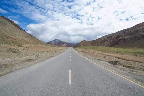
Leaving Kargil, NH 301 follows the Suru River valley, with the river flowing south to north from Pensi La back toward Kargil. The highway climbs through this valley before crossing Pensi La, a significant mountain pass near the Drang-Drung Glacier — likely the largest glacier in Ladakh after the Siachen system.
Beyond Pensi La, the highway enters the Stod (also called Doda) River valley, part of the greater Zanskar valley system, with the river here flowing in the opposite direction — north to south — toward Padum. Along this stretch, the route passes through small settlements including Akshu, Hamiling, Phey, and Tungri (home to Tungri Monastery), before finally reaching Padum.
Why This Highway Carries Strategic Significance
This region’s importance extends well beyond civilian connectivity. Areas near Kargil, including Tiger Hills, were part of the active war theatre during the 1999 Kargil conflict, and the broader Kargil-Zanskar corridor has remained strategically significant in India’s Himalayan defence planning ever since. NH 301 is specifically valued for its potential to support movement of troops and heavy equipment, a role that becomes even more significant with related infrastructure developments in the wider region, including the planned Shinku La Tunnel being built by the Border Roads Organisation on a connecting route.
Once fully developed alongside these related projects, this corridor is expected to also function as the shortest route to Kargil via Manali, Darcha, and Padum — reshaping regional connectivity patterns considerably.
Opening Up Suru Valley to Tourism
One of the more understated but genuinely significant impacts of this highway is its effect on Suru Valley specifically. Historically, most tourists heading to this region bypassed Suru in favor of Padum and Zanskar proper, simply because better facilities existed there. NH 301’s development is expected to bring meaningful tourist traffic into Suru Valley for the first time at scale, offering economic benefit to local communities that have largely remained outside the region’s existing tourism economy.
The highway is also expected to improve access toward Pangong Lake, bringing this iconic destination somewhat closer for travellers approaching through this southern Ladakh corridor.
Current Construction Status
This is genuinely important practical information: NH 301 remains under active, phased construction as of the most recent updates. The project has been divided into multiple packages — for instance, Package 6 covers upgrading a stretch from roughly Km 117 to Km 148, while further requests for proposals have covered continuing sections toward Km 196. Officials have conducted ongoing progress reviews, with target completion dates that have shifted over time; an October 2024 target was cited in earlier reviews, though construction of this scale in extremely remote, high-altitude terrain frequently sees revised timelines.
Given this, anyone planning to travel NH 301 should treat it as a highway genuinely in transition — expect a mix of upgraded intermediate-lane sections and stretches still under construction or awaiting upgrade, rather than a uniformly finished road.
Road Conditions and Seasonal Access
Given its high-altitude Himalayan terrain and the Pensi La crossing specifically, NH 301 is a seasonal route in practical terms, with winter snow significantly affecting accessibility much like other high-passes in Ladakh. The historic isolation of Zanskar during winter months — traditionally so severe that the frozen Zanskar River itself became the only viable travel route via the famous Chadar Trek — underscores just how significant year-round road access via this highway could eventually become for the region.
Speed Limits and Practical Driving Notes
Given the terrain, ongoing construction, and high-altitude mountain crossing involved, there’s no meaningful uniform speed limit to reference for this highway in the way flatter national highways have. Safe travel here depends entirely on current road conditions, weather, and construction status rather than any posted numeric limit — treating this as a careful, weather-dependent mountain journey rather than a standard highway drive is essential.
Challan and Practical Compliance Notes
Standard Motor Vehicles Act frameworks technically apply within Ladakh, but given this highway’s remote, still-developing nature, the practical safety priority for travellers is less about speed compliance and more about being genuinely prepared for high-altitude, weather-dependent mountain travel — carrying appropriate supplies, checking current road and weather status, and not attempting the route without adequate preparation for its remoteness.
FAQs
Q1. Is NH 301 currently complete, or should I expect construction along the way?
Expect ongoing construction. Multiple sections of this highway remain under phased upgrade work, and completion timelines have shifted over the project’s history. Check current NHIDCL and Ladakh administration updates for the latest status before planning travel.
Q2. When is the best time to travel NH 301 to Zanskar?
Given the Pensi La crossing and overall high-altitude terrain, summer months offer the most reliable access. Winter travel faces significant snow-related closure risk, consistent with the historic seasonal isolation this region has experienced.
Q3. Does this highway make Zanskar Valley more accessible for tourists now?
Yes, meaningfully so compared to historical access, though it remains a remote, developing route rather than a fully modern highway. Suru Valley specifically is expected to see increased tourist interest as the highway continues to develop.
Q4. Why does this highway matter beyond just connecting two towns?
Beyond civilian access, NH 301 carries genuine strategic significance given the region’s proximity to sensitive border areas and its history during the 1999 Kargil conflict. It’s expected to support both local economic development and broader defence logistics as construction progresses.